Copperwood Mine Facts
- The “Copperwood Mine” is not an active mine; it remains pre-construction.
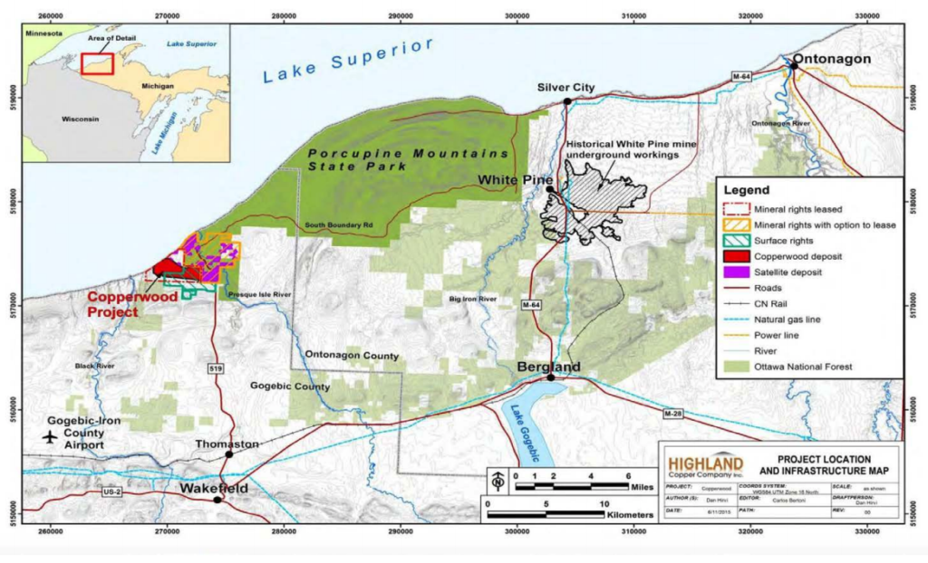
- The Copperwood Mine Project is located adjacent to the Porcupine Mountains Wilderness State Park, on the shore of Lake Superior.
- Copperwood is currently owned by Highland Copper, a Canadian company.
- Highland Copper acquired the Copperwood Project from Orvana Minerals in 2014 –along with permits previously issued by the Michigan DEQ.
- Map showing location of Copperwood Mine project in relation to the adjacent Porcupine Mountain Wilderness State Park:
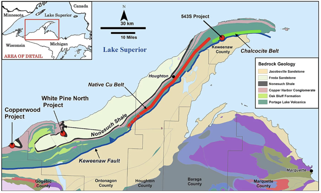
- Map showing location of Copperwood Mine Project and geology:
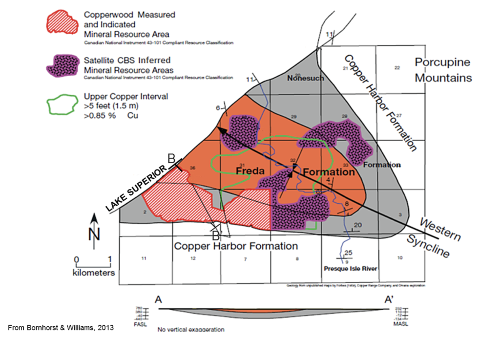
- Map showing location of Copperwood Mine Project and distribution of copper deposits:
- In 2018, Highland Copper requested multiple permit amendments from the DEQ’s Water Resources Division. In a Public Notice dated June 27, 2018:
Copperwood Resources, Inc., 310 US 2 East, , Wakefield, MI 49968, has applied to this office for a permit under authority of Part 301, Inland Lakes and Streams; Part 303, Wetlands Protection, and Part 325, Great Lakes Submerged Lands, of the Natural Resources and Environmental Protection Act, 1994 PA 451, as amended (NREPA). The applicant proposes to dredge and fill streams and wetlands and dredge and fill bottomlands of Lake Superior for the purpose of constructing a new copper mine including an access road, mine entrance, mill, tailings basin, water intake, and related structures. The mine will be a room and pillar mine with material being removed and ore processed on site before being sent off site for smelting. Tailings will be disposed on site and above ground. The project is located northwest of Camp 7 Grade and County Road 519, T49N, R46W, Section 01, Wakefield and Ironwood Townships, Gogebic County, Michigan, in accordance with plans attached to this notice.
Stream Impacts: Eleven existing stream crossing culverts will be removed and replaced with new pipe arch culverts of various sizes and lengths to match stream bankfull widths. Three new stream crossing pipe arch culverts will also be installed. These upgraded or new crossings will allow access to the mine site, water intake, mill site, mitigation site and other related facilities. Approximately 16,557 lineal feet of stream channel, including sections of Lehigh Creek and the West and East Branches of Gipsy Creek, will be abandoned during construction of the tailings disposal facility. Approximately 3,900 lineal feet of stream channel will be constructed to relocate a portion of the Middle Branch Gipsy Creek and approximately 8,560 lineal feet of stream channel will be constructed to divert surface water around the south and west sides of the tailings disposal facility.
Wetland Impacts: Approximately 7,295,157 cubic yards of fill will be placed in 43.48 acres of wetland and approximately 35,836 cubic yards of material will be excavated from 14.36 acres of wetlands to construct the main access road, the box cut, the mill site and processing plant, the mitigation access road and creation area, the ore stockpile area, the water intake road, the stream relocations and the tailings disposal facility.
Lake Superior Water Intake: A 2,715 foot long by 18 inch diameter pipeline will be installed in Lake Superior to supply water to the mine. Approximately 7,710 cubic yards of material will be excavated below the ordinary high water mark of Lake Superior to construct the pipeline and infiltration gallery and approximately 2,610 cubic yards of coarse aggregate and 4,770 cubic yards of rip rap will be placed to backfill the pipeline after installation. Approximately 330 cubic yards of sand and gravel and 40 cubic yards of gravel pack and 20 cubic yards of river rock will be placed around the infiltration gallery.
- Copperwood Mine plans to pull water from Lake Superior for industrial use, destroy streams and wetlands, and radically alter the hydrology of the site.
- Copperwood Mine is a project in the “final feasibility stage.” View Copperwood’s Technical Reports: https://www.highlandcopper.com/technical-reports and Highland Copper’s September 2018 Presentation to Investors.
- Major permits required for mining the Copperwood Project were previously obtained and/or approved in 2012 and 2013, subject to certain conditions, including providing financial assurance. Financial assurances have not been provided.
- Highland Copper now controls the Copperwood project, and is proceeding with required feasibility studies, additional exploration, and significant permit amendments.
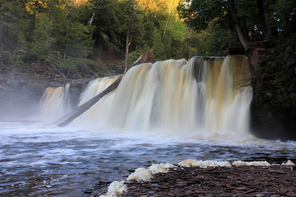
- Mining impacts (airborne pollutants, soils and waters contaminated with heavy metals) will degrade the natural habitat of the Porcupine Mountains, especially the Presque Isle Scenic Area and the Presque Isle Rustic Campground. Because the Copperwood Mine would be developed adjacent to the west end of the Porkies, it threatens the park’s wild and scenic values, including dark skies, clean waters, quiet environment, and a diverse ecological habitat supporting old-growth forests and predators. Several popular waterfalls are located in this area, including Manabezho Falls, Manido Falls and Nawadaha Falls.
By Yinan Chen (www.goodfreephotos.com (gallery, image)) [Public Domain], via Wikimedia Commons
- Copperwood Mine will produce an enormous quantity of waste — tailings and waste rock — which will be stored in huge tailings basins, on site, forever.
- What will happen in the future? Based on exploration drilling results, Highland Copper aims to mine underneath Porcupine Mountains Wilderness State Park land (“Porkies”). In statements to investors, Highland Copper has described this as as a phased operation, pursuing an orebody which extends underneath park land, under the scenic Presque Isle River and possibly underneath Lake Superior. In light of these statements, the Copperwood Mine permits’ total environmental impacts (based on the duration of the operation) are significantly underestimated. If the mine’s operational life is extended, the total quantity of waste will greatly increase, and plans for closure and reclamation will be delayed.
- Highland Copper talks about developing a MINING DISTRICT in this area, encompassing lands on both ends of the Porcupine Mountains Wilderness State Park, including the “White Pine North” project at the historic White Pine mine and mill site, 21 miles east of the Copperwood project. The White Pine site could potentially be used for milling ore and the permanent storage of environmentally hazardous mine waste. The White Pine site includes enormous historic tailings basins and contaminated brownfields; the tailings basins are so large they can be seen from space. The White Pine project is stalled, due to liability and financing concerns.
- Highland Copper’s interest in redeveloping the White Pine Mine site raises legacy contamination concerns. The site included an ore-refining smelter with a 500′ tall stack; new research shows that mercury emissions from White Pine Smelter contaminated a wide swath of the Upper Peninsula. See: Kerfoot, W. Charles et al. Mining legacy across a wetland landscape: High mercury in Upper Peninsula (Michigan) rivers, lakes, and fish. Full article available. Mercury emissions from the White Pine Smelter were approximately “640 kg per year” (1411 pounds). New mining activities in this area risk contributing new contamination, on top of legacy mine contamination.
- The Porcupine Mountains Wilderness State Park is a rugged, remote park located on the shore of Lake Superior, “grabbing widespread recognition alongside fabled national parks like Yosemite and the Black Hills” according to MLive.com. Cumulative environmental impacts to the Porcupine Mountains Wilderness area are greatly underestimated.
Files
- Public Comments of the Mining Action Group on the Copperwood Mine Permit Amendment Request, submitted to Michigan DEQ November 23, 2018.
- Copperwood Mine – Permitting Files (Mining Action Group’s browsable archive of materials submitted by Highland Copper to the Michigan DEQ re: permit amendment requests) – 2018
- Copperwood Resources, Inc. – DEQ Response to Public Comments October 10, 2018
- Copperwood Resources, Inc. – DEQ Notice of Public Information Session, Hearing, and Comment Period October 3, 2018
- Copperwood Resources, Inc. – DEQ Amendment request proposed decision September 25, 2018
- Copperwood Resources, Inc. – Depositional Analysis Update September 19, 2018
- Copperwood Resources, Inc. – Highland response to additional information request September 12, 2018. See: Associated Maps and Figures. See: Associated Reports.
- Copperwood Resources, Inc. – DEQ Request for additional information August 29, 2018
- Copperwood Resources, Inc.– DEQ Notice of Public Meeting July 17, 2018
- Copperwood Resources, Inc. – Addendum to Amendment Request June 26, 2018
- Copperwood Resources, Inc. – DEQ Response to Copperwood Amendment request April 20, 2018
- Copperwood Resources, Inc. – Request for Amendment to Copperwood Mine Permit MP012012
- Copperwood Resources, Inc. – Depositional Analysis
- Copperwood Resources, Inc. – Request for Amendment to Copperwood Mine Permit Environmental Impact Assessment
News
- Corporate Press Release: Highland Copper Receives the Wetland Permit for the Copperwood Project, Upper Peninsula, Michigan, USA – 10-30-2018
- Highland Copper Company moves forward with new copper mine – 6-19-2018
Issued Permits
- Copperwood Mine Mining Permit, issued to Orvana in 2012
- Copperwood Mine Wetland Permit, issued to Highland Copper in 2018 (pending)